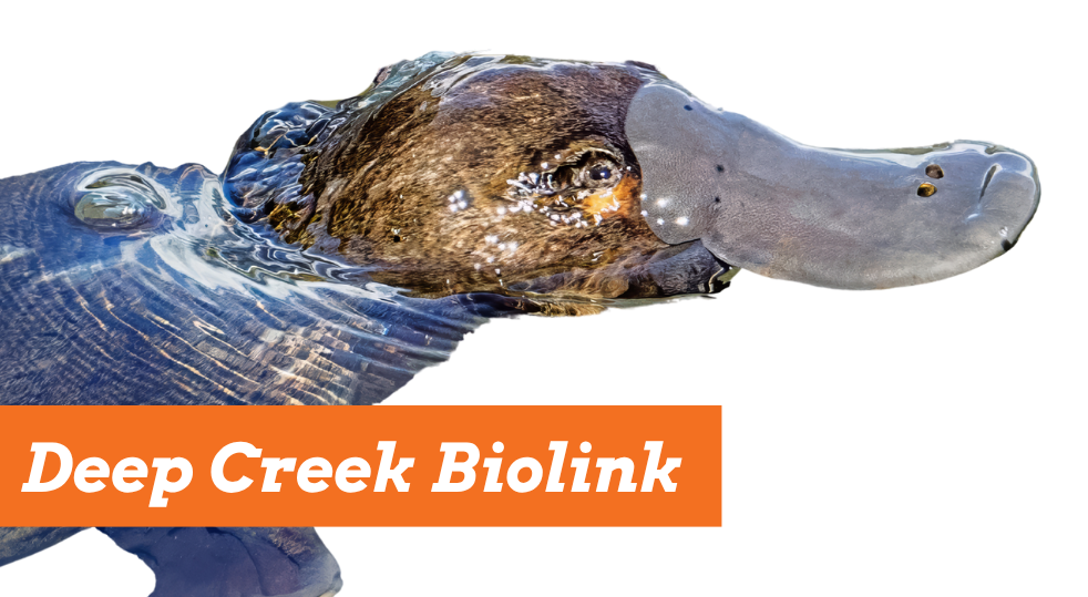
Deep Creek biolink
Creating a biolink for Upper Deep Creek
A new locally initiated and designed initiative, Deep Creek biolink, is a highly collaborative, science-driven project set to bring life back to the creek. Part of an exciting long term plan, this project is the first stage of establishing a biolink that will reach from Melbourne all the way to Echuca.
Led by local Landcare groups (Upper Deep Creek Landcare Network) and ecological experts from Biolinks Alliance, and with funding from Melbourne Water, the project aims to restore ecological connectivity and rebuild our creek’s biodiversity so it can be more resilient now and into the future.
Using simple and accessible ecological practices tailored to our local region, we are looking to partner with local landholders to improve water quality and rebuild habitat along our creek.

Deep Creek and the surrounding landscape, taken from Doggetts Bridge. Image: Cameron O’Mara
Invitation to Deep Creek landholders
You can play a critical part in this legacy for our community by supporting our efforts to improve the water quality and rebuild habitat around our creek. Not only will our creek be more resilient and thrive, but our local forests and farms will also be healthier.
If you are a landholder in the project area, we would like to work with you to improve the health of the creek and its tributaries where they run through your property.
The project area will include properties along Deep Creek from the southern end of the Cobaw Ranges, along Three Chain Road down to Sheehans Road, Romsey. See project map for detailed boundary.
Contact us now to register your interest.
Selected properties will receive a free consultation with a member of the Biolinks Alliance project team.
About Deep Creek

Deep Creek near Darraweit Guim Primary School, known platypus habitat. Image: Sasha Dobson
Deep Creek has always been important to our community. It helps keep our forests and farms healthy and brings people together. It’s a special part of our local area that many of us feel proud of.
The creek was once a healthier, more lively place where families would swim and picnic in permanent clear pools even during drought. But after years of degradation it has become fragmented and disconnected.
Despite this, local Landcare groups and individual landholders have made huge achievements in restoring the creek to bring back species like Koalas and Platypus.
This project is about creating a lasting legacy for future generations and building a stronger, healthier landscape. You can become part of the Landcare community, connect more deeply with your local landscape, and help promote and protect the iconic species that make our region special.
If the creek could speak, what would it ask of us? Let’s listen and act together.
Project Map
Click on the map to open interactive version.

Connectivity Modelling
Hear Cameron O’Mara and Dr. Chris Pocknee explain how to use the project map and its features.
Ecological connectivity modelling can be used to identify existing habitat linkages as well as potential new biolinks to restore connectivity in a specified area for a species or a group of species of interest.
For the Deep Creek Biolink project, Biolinks Alliance defined and ran connectivity models for project focal species using ArcMap Linkage Mapper. Species modelled were the Brush-tailed Phascogale (Phascogale tapoatafa), Koala (Phascolarctos cinereus) and various species of woodland birds.
The models identify core habitat areas within the study area for focal species, based on habitat type, habitat condition and minimum patch size requirements. It then used information on what poses a barrier to movement to those species to determine ‘least cost pathways’ or potential biolinks. Biolinks were modelled over a 2 km buffer around the Deep Creek catchment. The Deep Creek itself was assumed to be a key habitat area, given waterways do provide key habitat and act as biolinks themselves.
These models will serve a dual purpose: guiding the location of targeted habitat restoration works where possible, and engaging landholders within the project area by showing where their property sits within the key areas for these focal species to move across the landscape.
Core patch and connectivity pathway models produced very similar outputs for Brush-tailed Phascogale & Koalas and for woodland birds. The key difference is the presence of more, smaller core patches for woodland birds due to the parameterised smaller minimum patch size.
There are a number of key areas across the area that present as high priority connectivity pathways for both groups of species. Within the proposed biolink, the eastern and southern extent show strong potential for connectivity to the broader landscape. Just south of the western edge of the biolink is another area of high connectivity potential, linking to the Cobaw Biolink that is being led by Newham & District Landcare Group, connecting the Cobaw Ranges to Mount Macedon.
You can view more details about the project area, including the priority pathways for phascogales, koalas and woodland birds by visiting the online map.
Icon Species Present in the Landscape
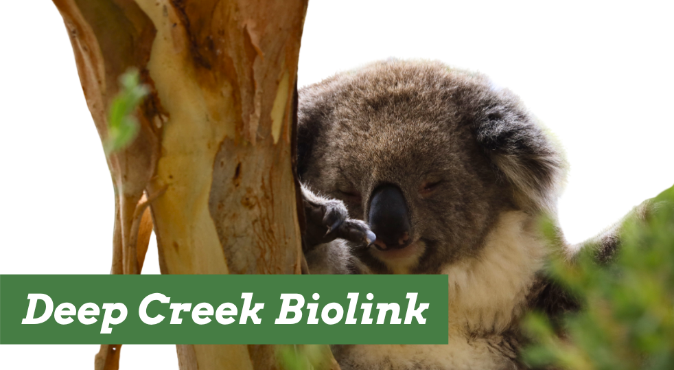
Koala

Image: Dr Chris Pocknee
The Koala is a flagship species for forest and woodland health, iconic and widely recognised. Its presence indicates large, connected, high-quality eucalyptus habitat. There are records of Koalas in the area going back decades and current populations in the Cobaws and Macedon Ranges represent a great opportunity for wildlife corridors.
Koalas thrive in eucalyptus forests and woodlands, particularly where preferred food trees are abundant. They require a mix of tree species for food and shelter, access to water, and safe, connected corridors—ideally at least 20 metres wide. Effective habitat management, including the restoration of native vegetation and careful planning in plantation areas, is essential for supporting Koala populations.
Platypus
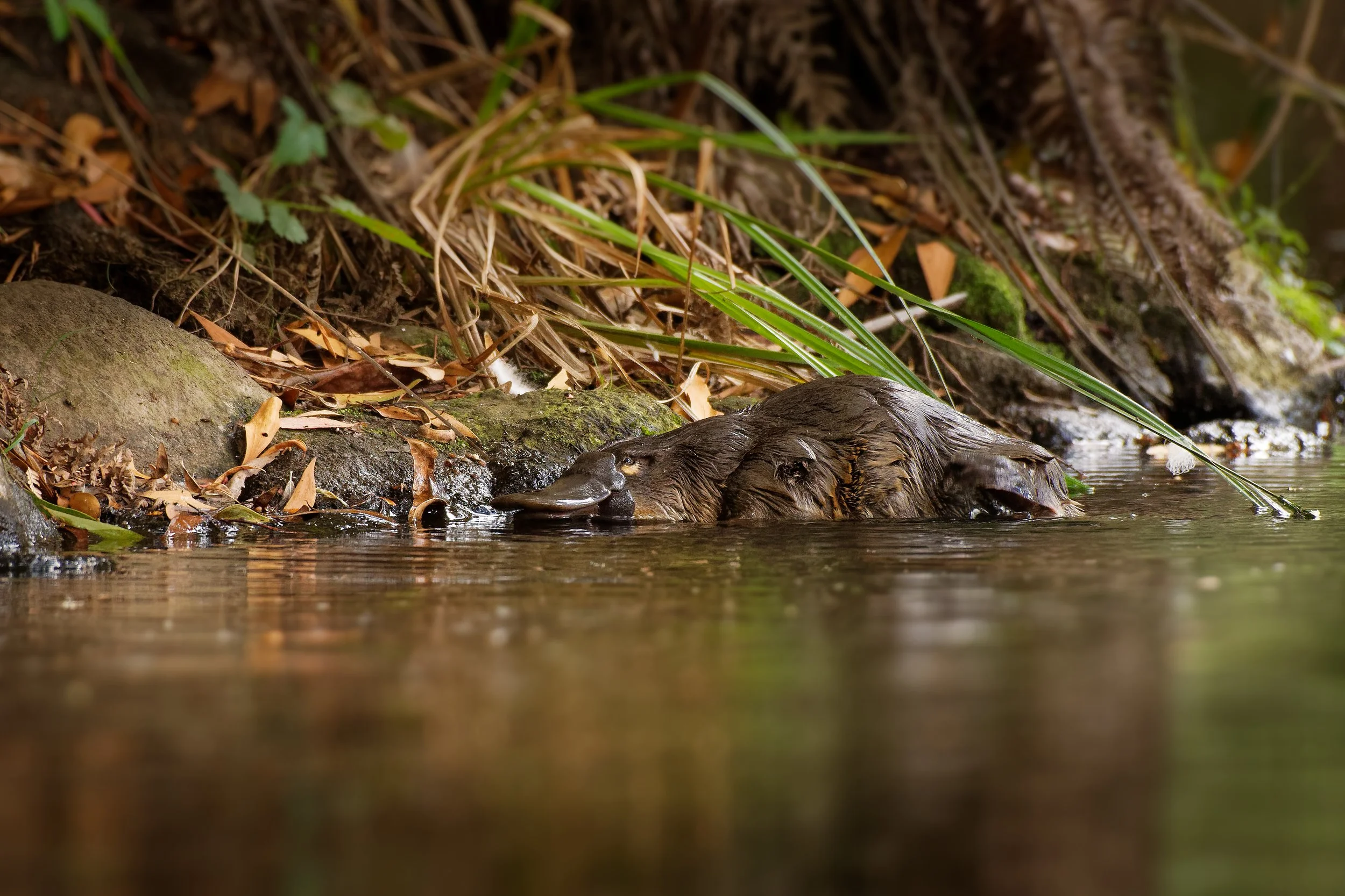
Image: Creative commons
The Platypus is a unique and iconic species found in freshwater ecosystems across eastern Australia. It serves as a key indicator of waterway health, and its presence reflects the quality of riparian zones and catchment-wide ecological function. Platypus have been recorded in Deep Creek as far north as Doggetts bridge however their occurrence has been significantly less over the last decade.
Platypus require clean, permanent, slow- to fast-flowing freshwater systems with intact riparian vegetation and stable banks for burrow construction. Healthy streamside vegetation provides shade, regulates water temperature, stabilises banks, and supports ecosystem health.
Hooded Robin
The Hooded Robin is a ground-foraging woodland bird that has suffered major declines across southeastern Australia due to habitat loss and degradation. It is a key indicator of the health of Box-Ironbark and grassy woodland ecosystems. Hooded Robins require open eucalypt woodlands with a healthy ground layer of native grasses and herbs, scattered shrubs, fallen logs, and low-intensity grazing. They need mature trees for nesting and open ground for foraging.
They are sedentary and territorial, with small home ranges (typically 10–20ha). However, population viability depends on connectivity. Given their minimal movement range they represent a need for well-connected forests and woodlands.
Brush-tailed Phascogale

Image: Chris Tsaros
The Brush-tailed Phascogale, also known as the Tuan, is a small, nocturnal, carnivorous marsupial that once occurred widely across much of south-eastern Australia. It is a charismatic yet rarely seen species, easily identified by its distinctive black, bottlebrush tail. The species is strongly associated with mature, hollow-bearing trees and healthy woodland understoreys. Its presence in the landscape signals intact habitat structure, making it an excellent focal species for woodland conservation and hollow habitat restoration.
Their dependance on hollows makes the importance of large old trees (hollow bearing 100+ year old trees) all the more significant.
Growling Grass Frog
The Growling Grass Frog is a large, vibrantly coloured frog once common throughout south-eastern Australia. It is now endangered in Victoria due to widespread loss and fragmentation of its wetland habitats. It is a strong indicator species for healthy, well-connected wetland systems.
Growling Grass Frogs rely on a network of permanent and ephemeral wetlands with aquatic vegetation, open basking areas, and good water quality. They breed in warm, shallow water bodies and require nearby refuge habitats during dry periods. Vegetated wetland edges and connectivity between wetlands are critical to their survival. Dams, of which there are many in the area, represent a key connectivity pathway for species like the Growling Grass Frog once they are enhanced by planting semi-aquatic and aquatic species.
Resources
Helping Woodland Birds Thrive
Simple, practical tips to support the woodland birds that rely on Deep Creek and surrounds for habitat
Restoring Habitat for Growling Grass Frogs
Easy ways to help create functional habitat for native frogs, including the Growling Grass Frog
Helping Koalas and Phascogales Thrive
Some effective strategies to protect and improve habitat for vulnerable species like Koalas and Brush-tailed Phascogales
Bringing Platypus back to Deep Creek
Waterway restoration and protection tips to help make the creek an inviting and safe place for platypus
Meet the Team

Cameron O’Mara
Biolinks Alliance’s Landscape Project Manager
If you would like to know if your property resides within the biolink area, or if you have any questions about the project, please reach out to Cameron by emailing cameron@biolinksalliance.org.au

Sasha Dobson
Biolinks Alliance’s Programs Manager
If you have any questions about the project, please reach out to Sasha by emailing sasha@biolinksalliance.org.au
Frequently Asked Questions
What is the aim of the project?
The Deep Creek Biolink Project is a new locally driven effort focused on restoring health to Deep Creek and its surrounding landscape. It brings together community members, landholders, and ecological experts to improve biodiversity, support productive land, and build resilience into the future.
Who is leading the project?
This is a collaboration between local Landcare groups, ecological experts from Biolinks Alliance, and is supported with funding from Melbourne Water. Together, we offer practical ecological knowledge to help landholders and communities regenerate Deep Creek and the land around it.
What has happened to the creek?
Deep Creek has long supported the communities that rely on it for agriculture, cultural connection, and recreation. It has played a central role in the identity of the region and has always been an important part of the local environment.
Once a thriving waterway, characterised by permanent deepwater pools, Deep Creek has been damaged over time. Water flow has been altered, water quality has dropped, and many native plants and animals have lost their habitat connectivity.
Species such as Platypus, Koalas, Phascogales, and Growling Grass Frogs are now much less common than they once were. As biodiversity decreases, the land becomes more vulnerable to drought and floods, and local productivity can suffer as a result.
Who can take part in the project?
If you are a landholder in the project area, we would like to work with you to improve the health of the creek and its tributaries where they run through your property.
We also run events and volunteer days that offer ways for other community members to get involved, learn more, and help restore the creek.
What happens if I join the project as a landholder?
We begin by listening. You can share your goals for your property and the creek, and we will work with you to shape a plan that suits your land and your vision.
The focus is on using simple, regionally proven ecological methods that are practical and effective. Restoring the creek can also support your land with improved shade and shelter, better water for livestock, and healthier soil.
Will I still have full control of my property?
Yes, you remain fully in charge. All work is done in partnership with you, and nothing happens without your agreement. The goal is to support your priorities with ecological tools that help you get there.
Where is the project happening?
The project follows Deep Creek from the Cobaws to North East of Romsey.
It forms part of a broader effort to repair and reconnect waterways that flow all the way from Melbourne to the Murray River near Echuca.
What kind of on-ground work is involved?
The activities depend on the condition of each site. In most cases, this could include:
Planting native suitable vegetation to reduce erosion and improve habitat
Fencing to protect sensitive areas from livestock
Controlling weeds and invasive species
Improving water quality through plant-based filtration and erosion control
Enabling you to participate in citizen science
How long will the project run?
The project is set to continue over the next several years.
What if I don’t want work done on my property?
There is no obligation to participate. If you are unsure or simply want to learn more, we welcome the opportunity to have a conversation. You can decide what feels right for you.
Acknowledgements
This project is in partnership with Upper Deep Creek Landcare Network, Biolinks Alliance, and Macedon Ranges Shire Council and with funding from Melbourne Water.
